Innovation
Ground-based, weather sensor network to provide Vertical Takeoff and Landing (VTOL) and Uncrewed Aircraft System (UAS) vehicles with the real-time, low-altitude, high-fidelity, meteorological data needed to operate in low altitude airspace.
Objective
Ohio’s “LAWN” (Low Altitude Weather Network) will provide VTOL’s, UAS and the Advanced Air Mobility (AAM) ecosystem with the weather data needed to reduce accidents, comply with Federal Aviation Administration (FAA) regulations, and improve operator efficiency in the low-altitude airspace they frequently use.
The five-year economic impact will be 75 jobs producing/supporting sensors as well as the software development and support.
The large Ohio-based team will create 12 Student Experiential Engagement (SEE) program positions and engage with NASA, AFRL and NAMRU-D for internships and shadowing.
Background
Weather satellites, ground radar and vehicle-mounted sensors are not currently capable of providing low-altitude meteorological data to support safe or efficient VTOL operations; thus, NASA, USAF, and industry have identified lack of low-altitude weather data as a critical need for the VTOL industry.
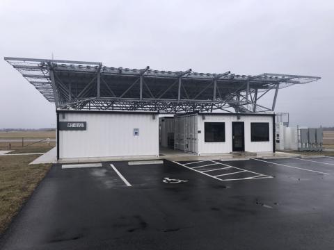
To address this need and accelerate Ohio to the forefront of aviation industry support; the team will build and deploy an inexpensive, scalable, ground-based, weather sensor network whose data will be used to provide a real-time, state-wide, high-fidelity, low-altitude, atmospheric environment visualization.
There are several weather factors critical to VTOL’s and other air vehicles. Starting with 25 networked sensors spaced at one mile increments, the LAWN technology will gather meteorological data using commercial off the shelf (COTS) components and communicate that meteorological data to a server. Using existing 3D Weather Visualization Tech developed with the FAA and being enhanced via a USAF Agility Prime contract, Flightprofiler will then produce a computer-generated, low-altitude atmospheric visualization for VTOL, UAS and AAM pilots & controllers.
After launch, coverage will spread to more of Ohio and then be expanded to cover other states.
Flightprofiler will produce the low altitude visualization, Ohio University will lead data management, and Ohio State Center for Design and Manufacturing Excellence (CDME) will lead sensor development and production.
Three federal partners are collaborating with our team: the Air Force Research Laboratory (AFRL) is utilizing this technology for Agility Prime, NASA is focused on weather sensors and airspace management, and Naval Medical Research Unit Dayton (NAMRU-D) is focused on safer patient transport in austere environments.